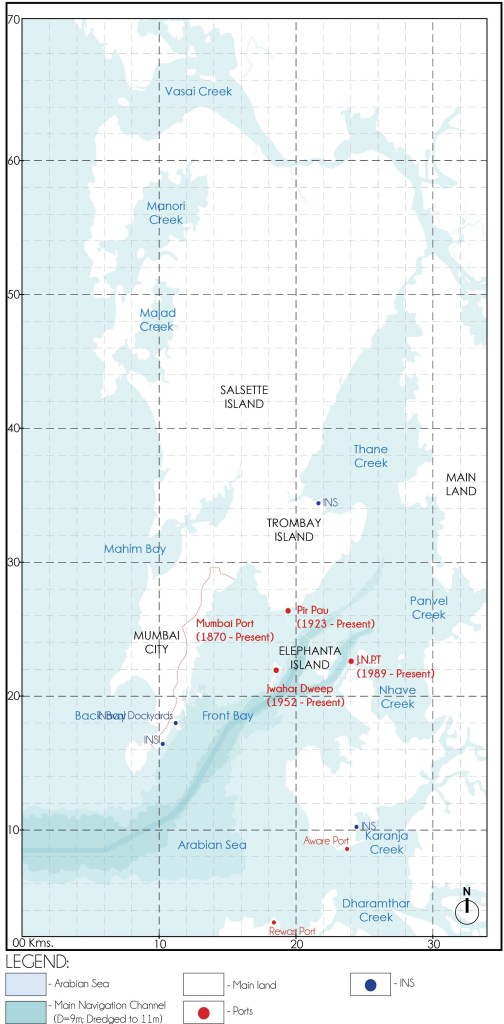
For the unversed, Mumbai Harbour a.k.a Front Bay is better associated as the Bay adjoining the Gateway of India in Mumbai. As shown in Fig. 01, it is a funnel shaped, natural deep-water harbour in the southern portion of the Ulhas River estuary. The narrower, northern part of the estuary is called Thane Creek. The harbour opens to the Nhava creek and Panvel Creek in the East; Karanja Creek and Dharamthar Creek in the South-East whereas into the Arabian Sea in the South-West.
The Front Bay is located between long. 72.84°E – 73.03°E and lat. 18.89°N -19.20°N. It admeasures about 36kms North to South and about 15kms East to West.
Source: Author
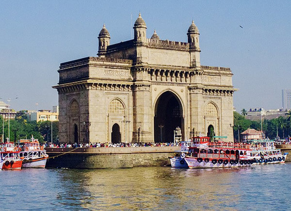
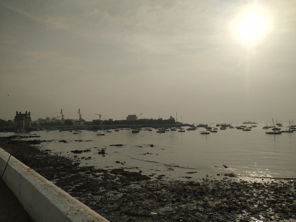
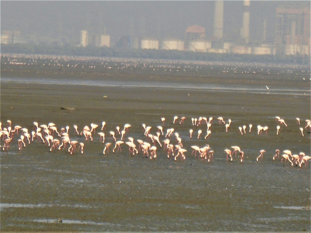
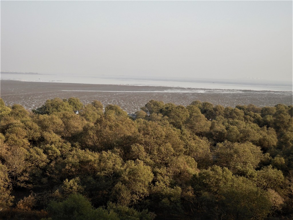
The Mumbai Harbour is surrounded by Mumbai City towards the West, the Mumbai Suburban Region in the North-West and the mainland of Navi Mumbai towards the East. In addition to facilitating important port activities, the Mumbai Harbour is dotted with multiple tourist attractions of historic and ecological importance some of which are shown in Fig.02-Fig.05.
Source: Author
Source: Author
Source: Author
THE RISE AND DECLINE OF MUMBAI PORT
The island city of Mumbai began its journey to become India’s financial capital from a humble archipelago of seven agrarian islands dotted with paddy fields, protected by marshes, and blessed with the deep but safe waters of the Front Bay forming a natural harbour – an ideal setting for the initiation of Port activities in the region.
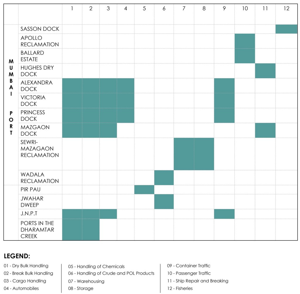
For about one and a half centuries, port activities have flourished in the island city and new ports have developed in the Mumbai Harbour as shown in Fig.01. These include the ports at Pir Pau for handling of chemicals, Jwahar Dweep for handling of crude and POL products, Nhava Sheva for handling of container traffic and at Dharamtar Creek for handling of break and bulk cargo utilizing the Mumbai Port navigation channel. Fig. 06 details out activities of all the Ports in the Mumbai Harbour.
Source: Author
However, since the past three decades post the MMR Plan of 1971-80, port activities have been on the decline in the island city due to factors such as:
- The MMR Plan of 1971-80 that aimed at decongesting the island city and therefore proposed that the city be envisioned and further developed as a service provider.
- Industrial closure and shifting of industries to the outskirts of the island city.
- Change in the profile of goods transported through waterways.
- Geological boon constrained by anthropogenic and geomorphological processes that have taken place in the past two centuries impacting the draught depth of the Front Bay.
There is considerable research on the gradual under-utilization and ultimate abandonment of Mumbai’s docklands due to policy changes, industrial closure, and changes in the profile of goods transported through waterways. However, the physiographic characteristics, anthropogenic activities and geomorphological processes responsible for the reduced draught depth of Mumbai Harbour’s main navigation channel to a mere 9m remains largely neglected. This reduced draught depth fails to comply with the requirement of modern shipping standards.
Ports and associated activities have been the foundation of Mumbai’s economy and for their successful continuation, provision of a draught depth complying with the modern shipping standards is obligatory. This feat can only be achieved by understanding the factors responsible for initiation and expansion of Port activities in the Mumbai Harbour.
FACTORS RESPONSIBLE FOR INITIATION OF PORT ACTIVITIES IN THE MUMBAI HARBOUR
The 21st Century Mumbai Metropolitan Region (MMR) comprises of the Mumbai Suburban Region and the island city. Reclamation of intervening waters separating the islands of Sasashti, Gorai, Dharavi, Bandora, and Trombay formed the Mumbai Suburban Region.
Alike the Mumbai Suburban Region, the island city was not one but seven amorphous islands separated by intervening tidal waters. These islands were formed during pre-historic times by a series of upheaval and subsidence creating the archipelago of Mumbai.
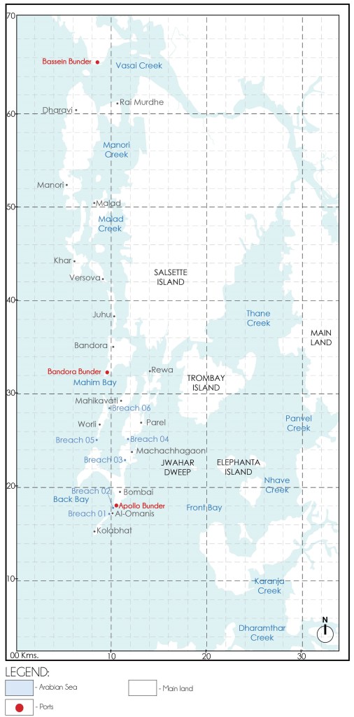
The earliest known accounts of Mumbai and its environs establish that port activities were carried on from Padav Bandar located on the island of Mumbai, Bandora Bandar located on Bandora island and Bassein Bandar located at present day Vasai as shown in Fig. 07.
However, it is noteworthy that unlike the port activities at Bandora Bandar and Bassein Bandar, port activities at Padav Bandar along the archipelago of Mumbai adjoining Front Bay have expanded and flourished for over three centuries
These port activities have been instrumental in raising the position of Mumbai from a set of humble agrarian islands to India’s financial capital and a global metropolis.
Source: Author
This phenomenal rise in port activities along the Mumbai Harbour can be attributed to the following four factors namely:
- Strategic location along the Western Coastline of India.
- The physiography of Mumbai Harbour.
- The oceanography of Mumbai Harbour.
- The tidal exchange between the Front Bay and Back Bay.
- The resultant geomorphological processes peculiar to the region.
References:
- The Rise of Bombay: A Retrospect Author: S. M. Edwardes Publisher: Times of India Press, Mumbai, 1902
- A Study on the Eastern Waterfront of Mumbai: A Situation Analysis conducted between August 2000 – December 2001 Author: Design Cell: Kamla Raheja Vidyanidhi Institute of Architecture and Urban Design Research Institute. Publisher: Urban Design Research Institute, Mumbai, 2001.
- Tides of Time: A History of Mumbai Port Author: V. M. Kamath Publisher: Mumbai Port Trust, Mumbai.
Author’s Note:
If this topic interests you, explore the category titled the ‘The Dissolution of Mumbai Harbour‘ . The published articles under this category include:
- The Dissolution of Mumbai Harbour: An Introduction
- The Dissolution of Mumbai Harbour: A Conducive Setting
- The Dissolution of Mumbai Harbour: Influence of Anthropogenic Activities c. 1650-1668 A.D.
- The Dissolution of Mumbai Harbour: Influence of Anthropogenic Activities c.1668 to 1873 A.D.
- The Dissolution of Mumbai Harbour: Influence of Anthropogenic Activities c.1873 to 1914 A.D.
- The Dissolution of Mumbai Harbour: Influence of Anthropogenic Activities c. 1914 to 1947 A.D.

Leave a comment